It's not a big surprise that a mix of native and alien plants will appear on farm fields that are no
longer plowed. But in New Castle how fast did it occur, where did the plants come from, and how like what used
to be there.
Some of these questions can be addressed from aerial photos. We are lucky to have available images from
the
collection of the entire state as
4000 by 2000 pixel tiles.
They photos below from 1926 to 2017 are from tiles 186 and 187.s
1926  |
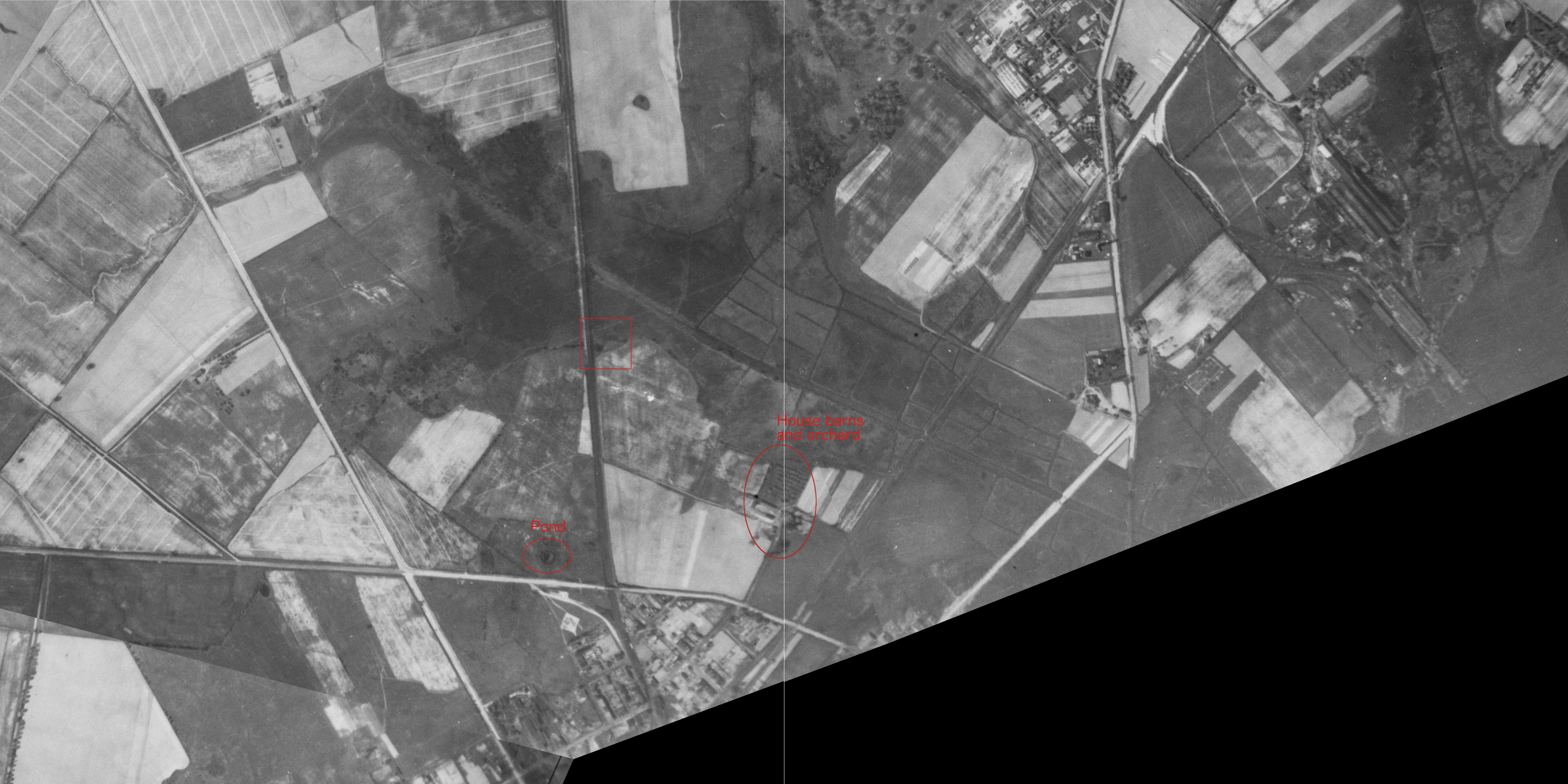
To orient you, the Hermitage is east of Basin Rd, north of Route 9, crosses the former Industrial Track
Railroad (now Markell Trail) to the ?? rail road, and south of the broad dyke ditch through marsh land. Note the farm house (Hermitage
, outbuildings and an orchard with about 6 by 8 rows of trees. Ted Megginson and Selden Deemer who lived in the house
between the 1930's and 1960's recall that there were apple trees in the orchard. Note that essentially all the land that is not
marsh is farmland with no trees. A pond near route 9, now about where Carrie Downie Elementary is a pont which served as a source
of ice which was stored in the ice house near the house. A dark area on the photo near the railroad adjacent to the marsh
may have been a bush or tree. There are none of the three schools which will show up in later photos.
There are no housing developments above route 9 or adjacent to the marsh and apparently no wooded areas either.
|
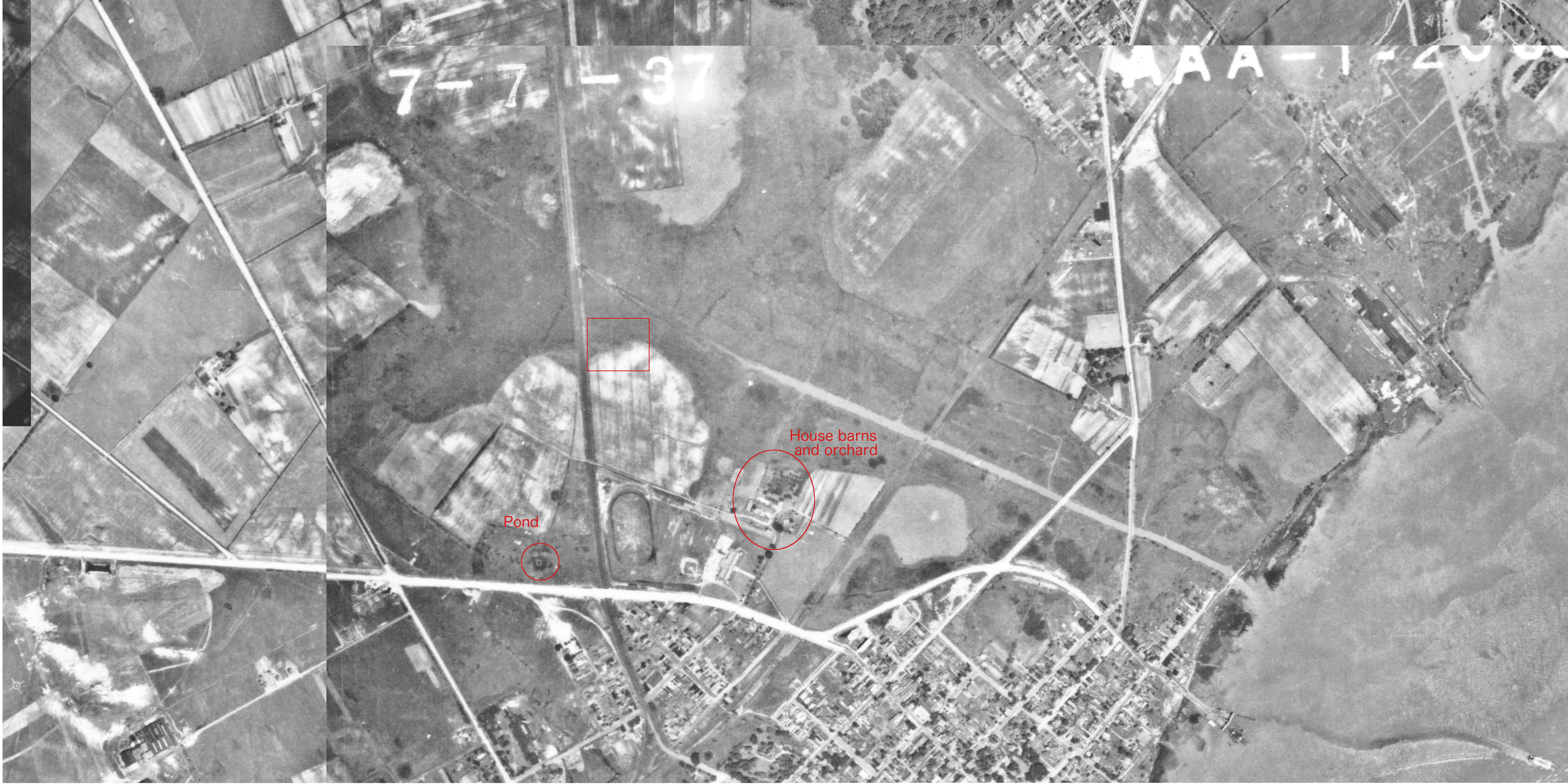
1937  |
Eleven years later, maybe half the apple trees are gone, along with the possible tree next to the marsh.
There are few if any trees on the border between the fields and the marsh. The pond is still there.
The first school, Wm. Penn, has been built near the Hermitage mansion, with baseball field and track.
|
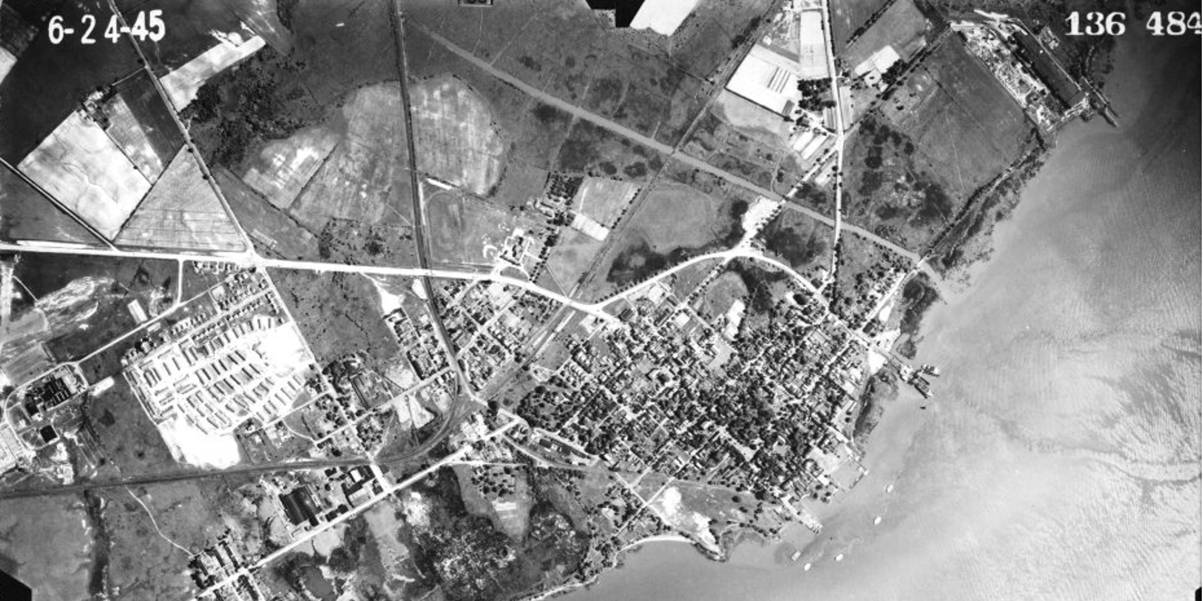
1945 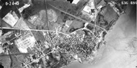 |
A wooded area has started west of the Hermitage farm. The orchard reamains about the same, many trees or bushes
are along the drive to the mansion, along the railroad to the east, and along the edge of the marsh on both sides of
what's now the Markell trail. Carrie Downie school has not yet been built.
|
1954  |
|
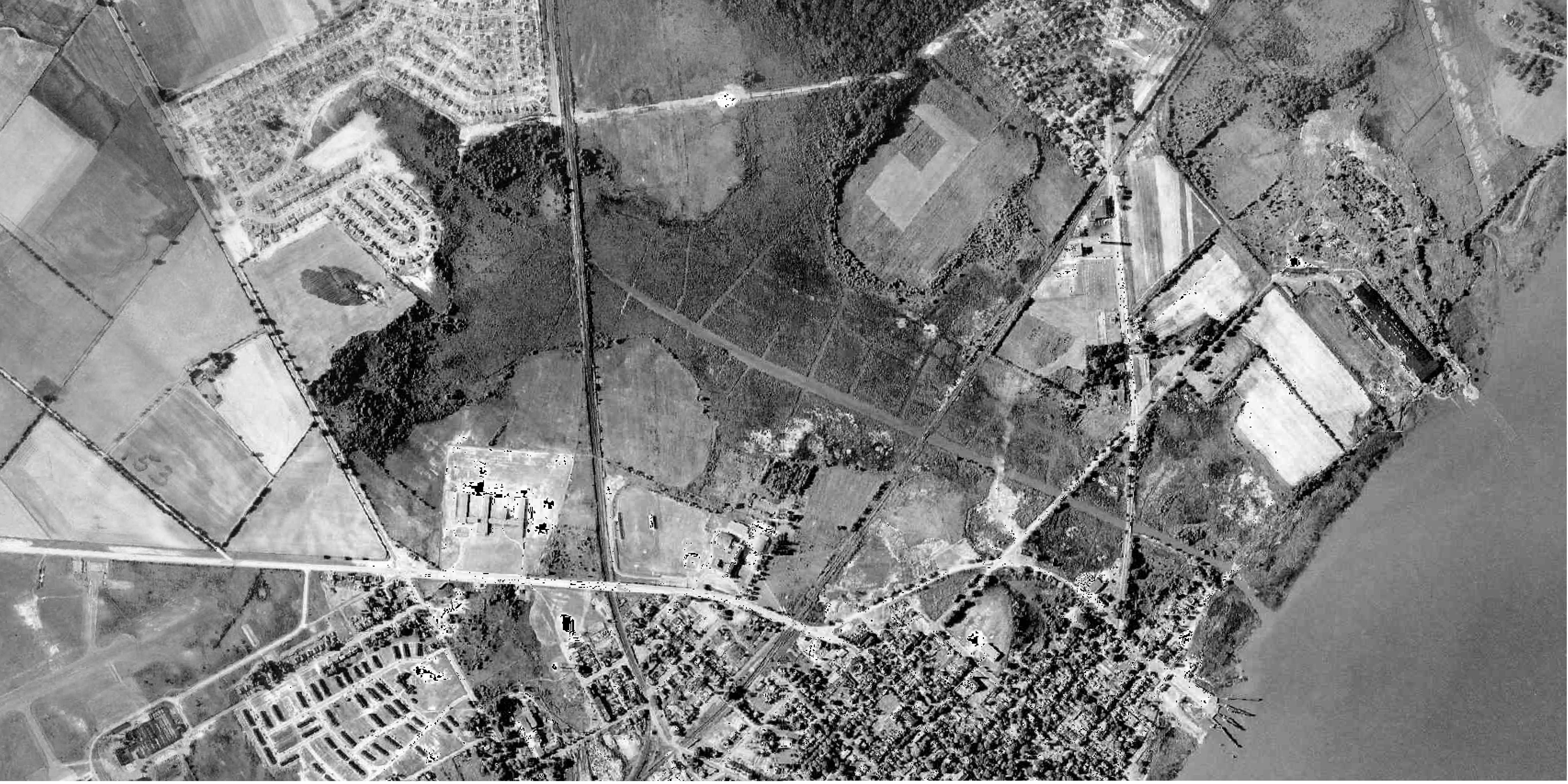
1961 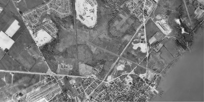 | Prominent trees on the edge of
the marsh east of the Markell trail (probably the pin oaks that are there now.) Apple orchard no longer visible below the house.
Stone barn west of the house maybe now roofless. Object downhill of the mansion; possible swimming pool.
|
1968  | stuff |
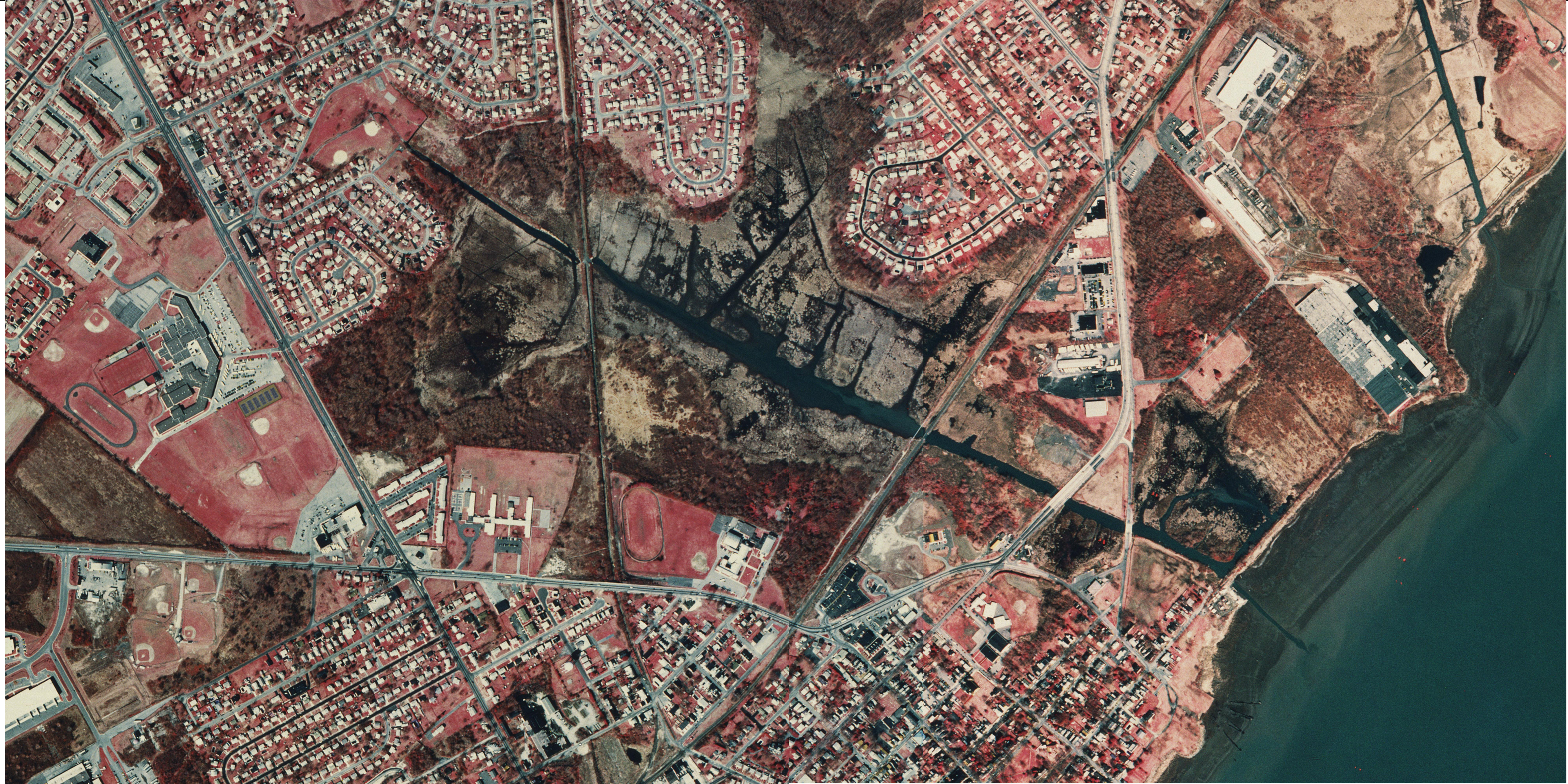
1992 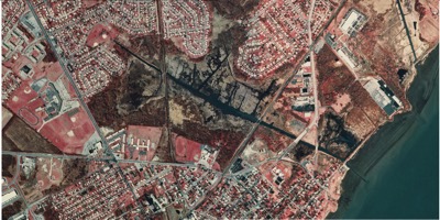 | Trails from a dirt bike park
cover most of the area on the east side of what is now the Markell trail. There is no obvious trails in the adjacent marsh. |
1997 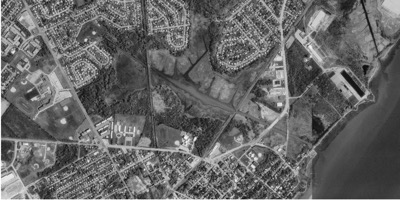 | The dirt bike park is still prominent.
Aside from that area, the property is almost completely covered by small trees. Possible swimming pool and orchard are now gone |
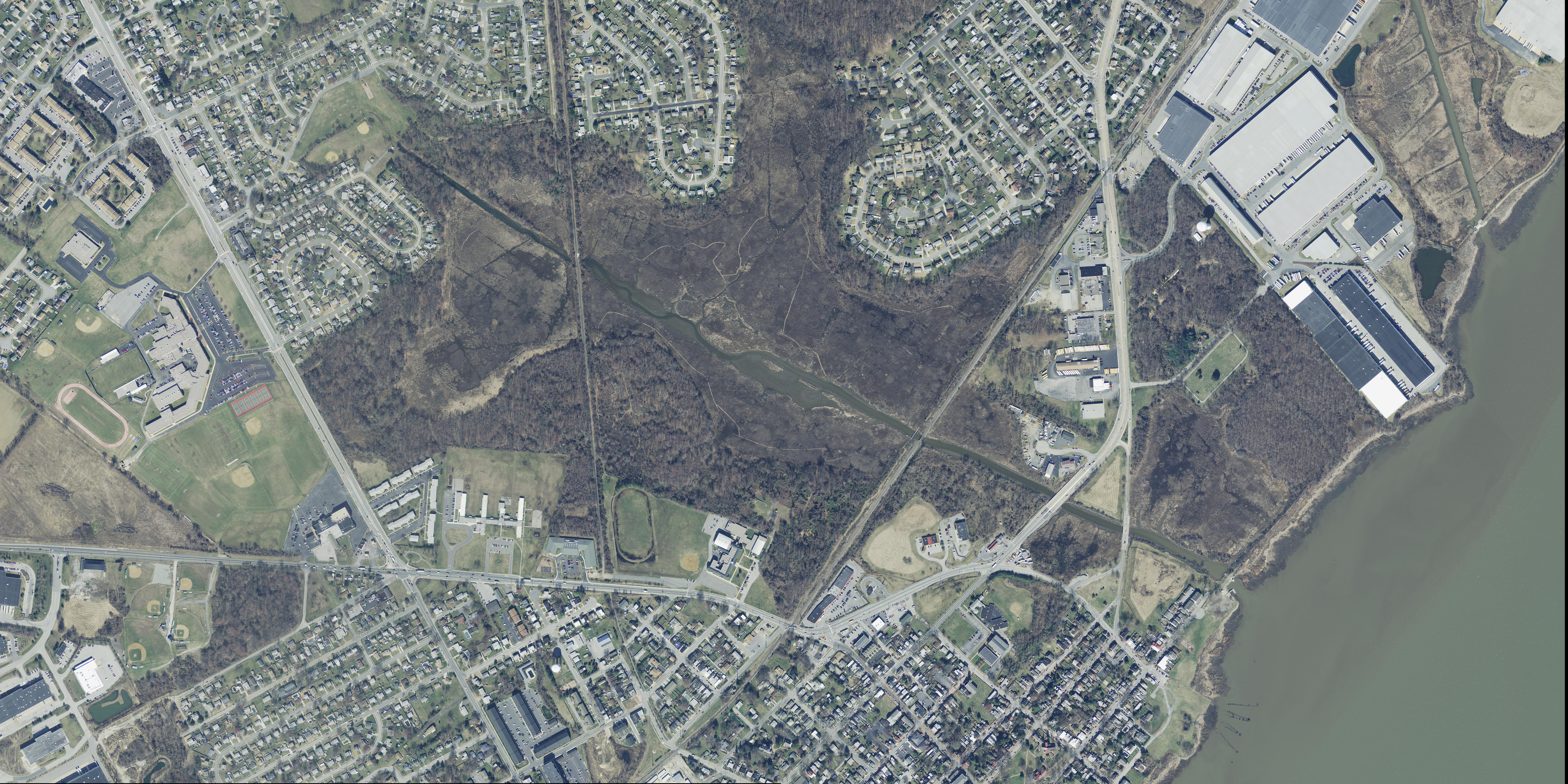
2007 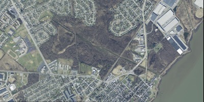 | The dirt bike park is now
barely visible, but there is a prominent path in the marsh on both sides of the canal. |
2012  | stuff |