DATA FILES
Plan and Elevation
Files:
(Courtesy Delaware Public
Archives, Dover)
| plan.jpg (bw, 1.2 mb) waterfront4.jpg (color, 400kb) 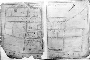 |
frontstreet_color3.jpg
(350kb) frontstreet_color2.jpg (2 mb) 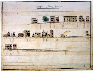 |
delaware_street.jpg
( 350 kb)
|
 |
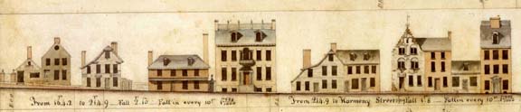
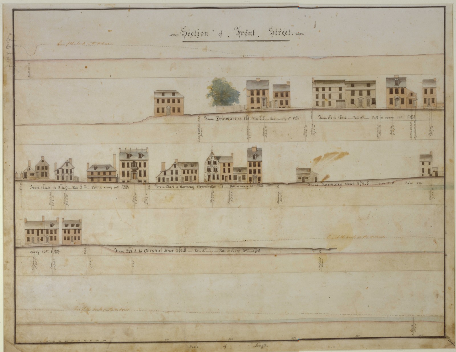
The elevation shows not only
houses on one side of Front Street (The Strand), but also the elevations
and distances from intersections. In accordance with this plan,
street levels were changed to promote drainage.
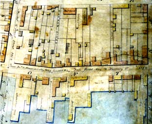
In the plan, brick buildings are tan, wood buildings are yellow, stables are grey. |
ArcGIS files (zipped)
Tax parcel shape files were obtained by extracting the desired data online from the New Castle County ePacel viewer.
Infrared orthophotos (both 1 m and 0.25 m) were provided by Research and Data Management Services (RDMS) at the University of Delaware. Only the 1 m data may be shown on the web due to limitations in 'acceptable use'
Overlay details: The scanned original of the survey was split using a photo editor on the edges of Harmony street, then background removed digitally. The tax parcels and ortho images as obtained from New Castle County and the University of Delaware were in different projections. After changing the projection of the orthophotos to that of the tax parcels in ESRI ArcMap, slight deviations still existed. The orthophotos were therefore georeferenced to the tax parcel map. Each page of the cleaned survey was georeferenced to these maps, primarily on street corners and a few existing buildings in page 1 (Van Leuvenigh, Gunning-Bedford, Kensey Johns and McWilliams houses) and on street corners for page 2. Shape files were initially created using ArcScan, then manually edited.