New Castle Waterfront South of Harmony Street
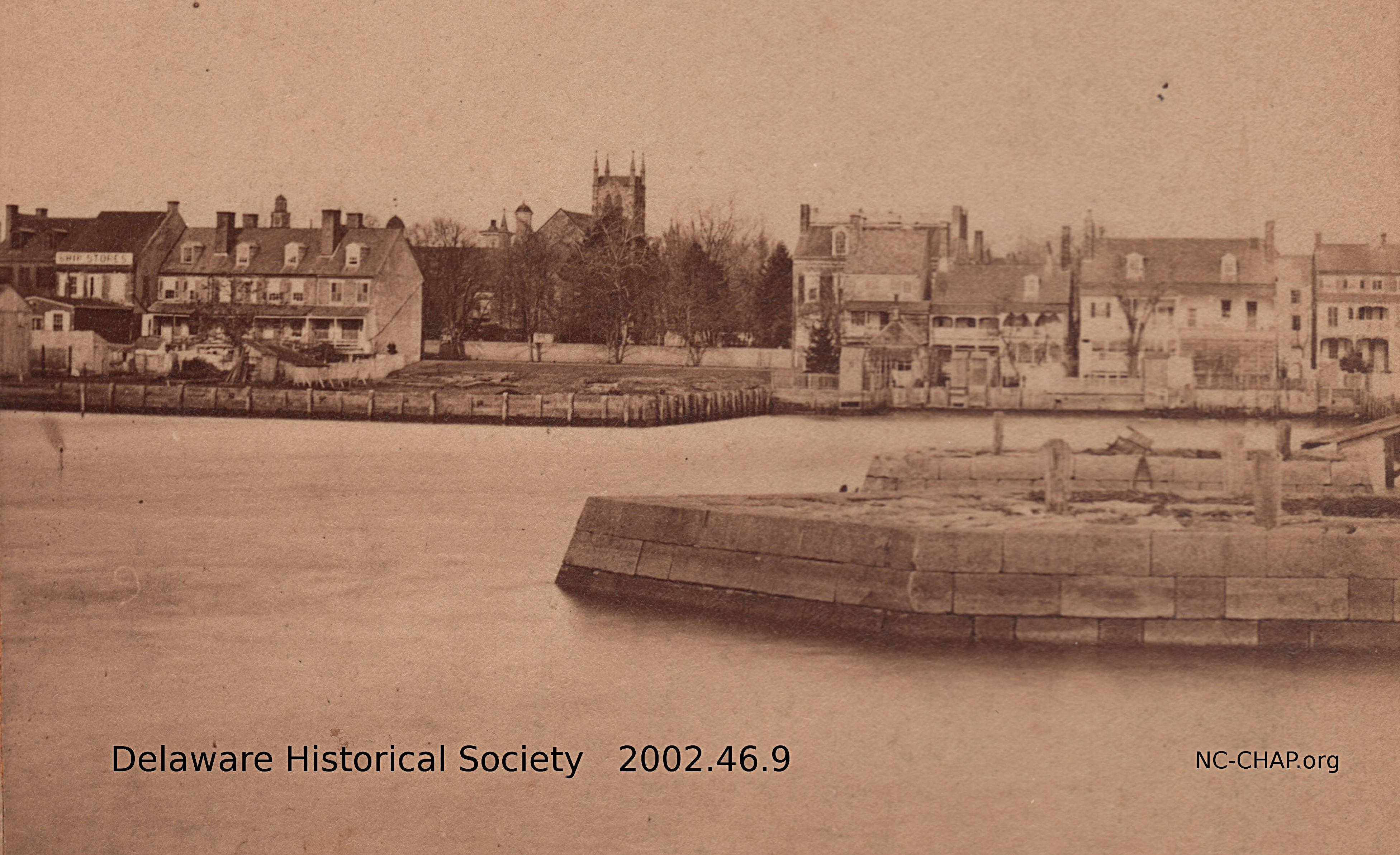
From a stereograph courtesy Delaware Historical Society. Click on image to enlarge
This view shows the river side of buildings on The Strand. Included are #25 (next to Packet Alley, the "Ivory Soap" building, here labeled "Ship Stores"), McCullough's row (27-33), the Read House (#42) and the house torn down by the Lairds c1930 to improve the view from the Read House, and houses 49-59 with their outhouses. In the alley next to the right-most house we can see a bit of the Dutch Tile House (torn down in 1884). Also shown are two ice breakers, one hexagonal, and one rectangular that is currently adjacent to the Laird yacht basin.
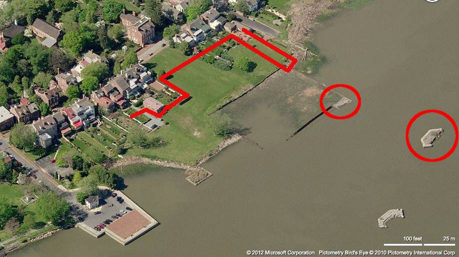 In the aerial view, the ice breakers are circled, and the approximate location of the shoreline on the 1805 Latrobe survey is drawn. The lots granted by Penn extended 600 ft into the river, approximately halfway between the two ice piers. In some lots, landfill now extends about 2/3 of that distance.
To the left of the c1880 picture, in front of the "Ship Stores" building is a one story building with a shallow sloped roof. This building, now a residence, was earlier the headquarters of the Packet Alley Tennis Club, and still earlier, a stables or carriage house.
The gothic Presbyterian church (1854-1950) on 2nd street rises above the trees of the Read House garden.
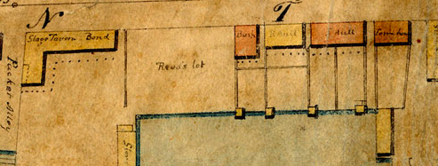 The Latrobe plan includes some small wooden structures next to the water. I had assumed that these were fishing or boating sheds of some sort, but it may be that they are the predecessors of the outhouses in the above photo.