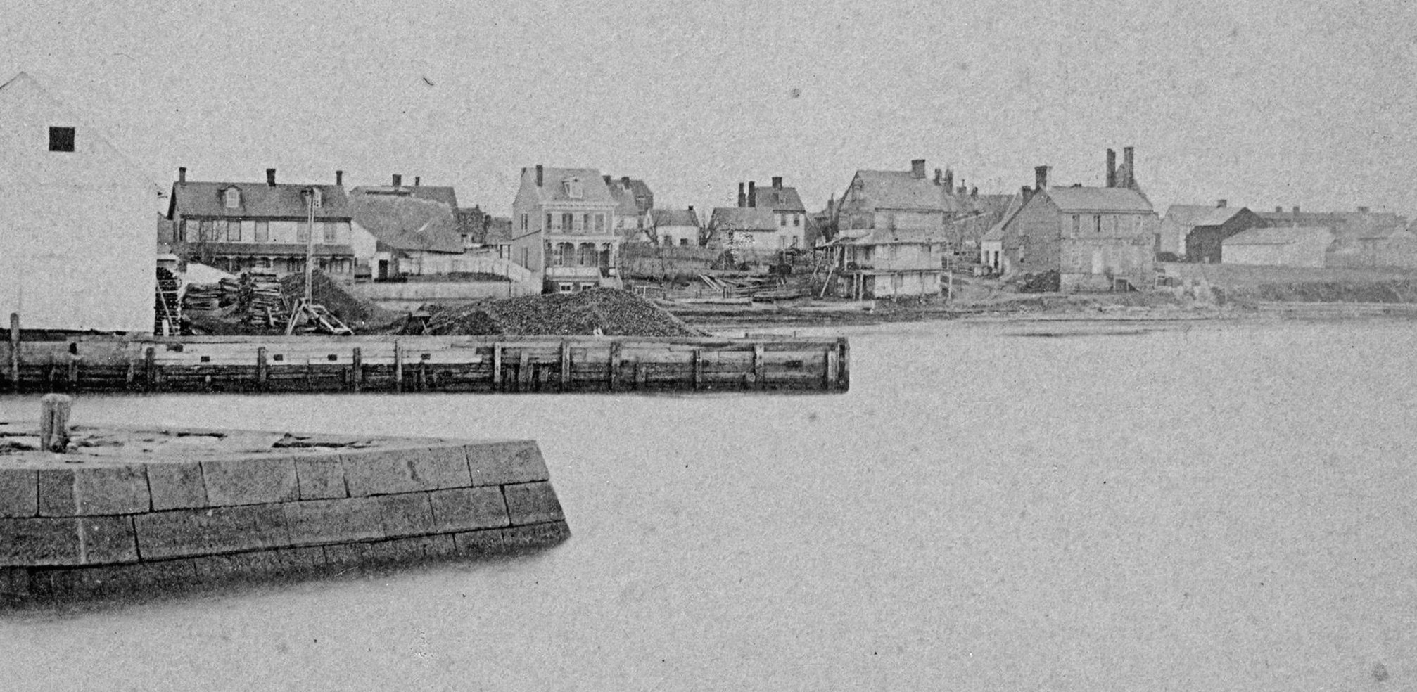
New Castle Waterfront North of Harmony Street
 From stereograph 267-008 courtesy Delaware Public Archives. Click on image to enlarge
There are four or maybe five houses in this c1878 picture of The Strand upriver of the Harmony Street wharf. Of these, all but one of the houses are gone. The one survivor, the "King House" (100 The Strand), is the house just to the right of the shed at the end of the Harmony street wharf. Its 2nd floor windows are grouped in an unusual 3 and 2 pattern, and they and the gingerbread trim on the porch are still visible today. It's called the King house because of "Zippy" King, the town iceman owned it around 1900.
A recently rediscovered 1904 newspaper story reports the destruction of "The Cave".
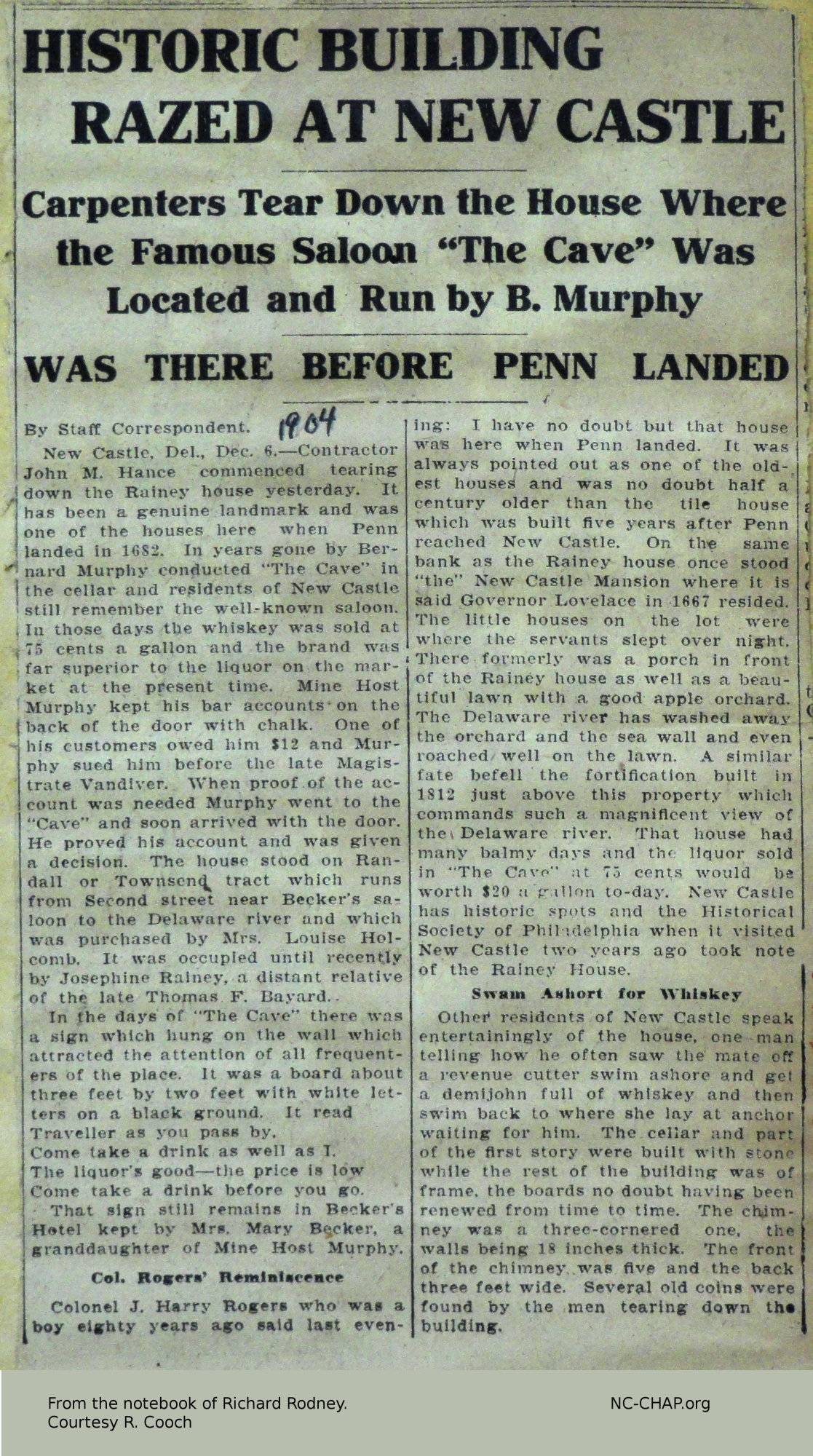 The story claims the building dated to before Penn's arrival in 1681. It describes the building as a frame house with the basement and part of the first floor of stone, and an apple orchard by the water.
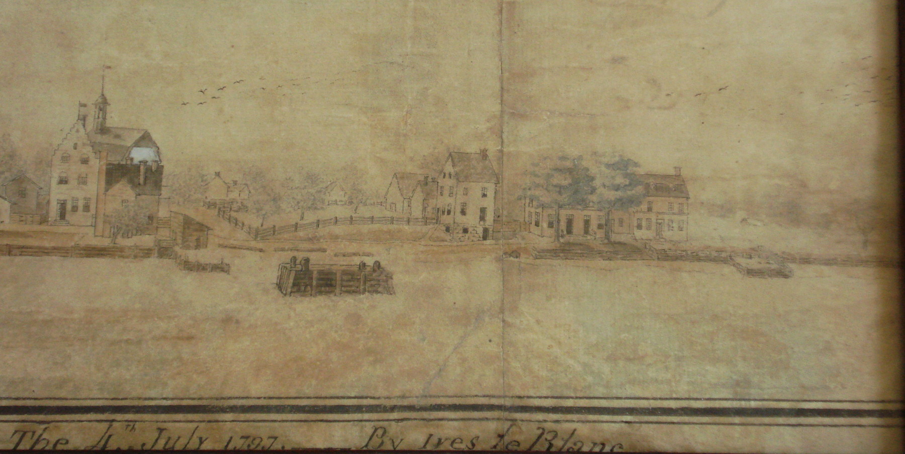 Where exactly was it on The Strand, and when might it have been built? Some clues come from earlier drawings and deeds.
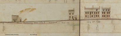
A detail from the Le Blanc drawing of 1797 shows a 2 1/2 story
square house with stone basement at water level. There was no suggestion of an orchard in front in 1797.
Where exactly was it on The Strand, and when might it have been built? Some clues come from earlier drawings and deeds.
A detail from the Le Blanc drawing of 1797 shows a 2 1/2 story
square house with stone basement at water level. There was no suggestion of an orchard in front in 1797.
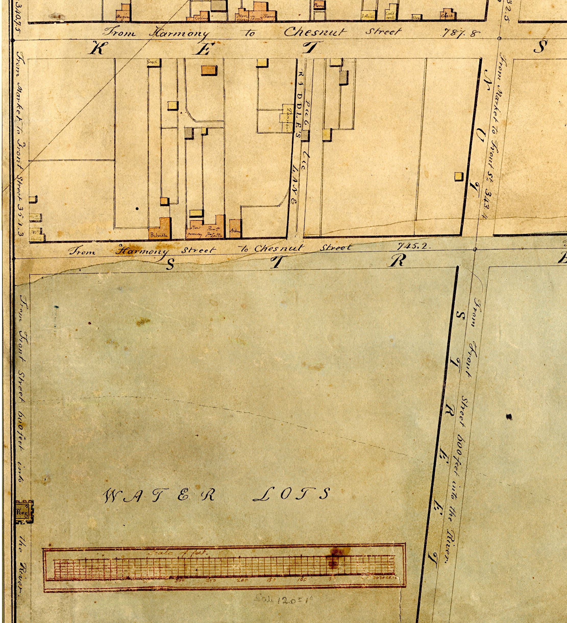
The Latrobe Survey 7 years later shows a structure 200 feet from the corner of Harmony both in plan view and as an elevation. (This would currently be at the Cashman's residence.) The L-shaped building is labelled "Belville" in plan view and may have a square portion on the left with a rectangular extention on the right. The elevation shows a 2 1/2 story building on the left, and a one story section on the right, possibly a workshop, stable or storehouse.
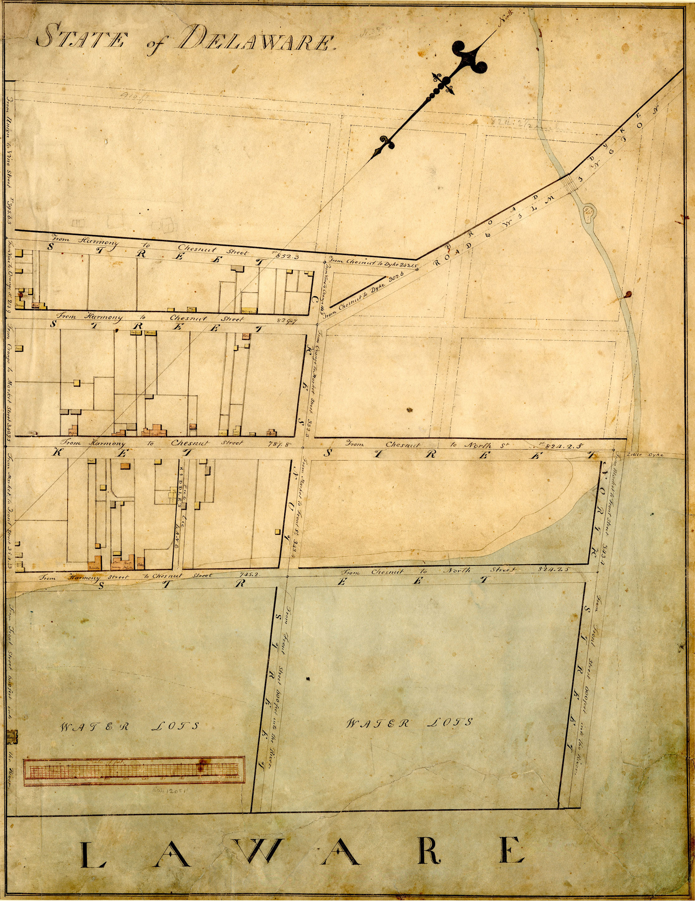
 Although just below the site of Ft. Casimir, the block of The Strand between Chestnut and Harmony has always been less developed than the
block between Harmony and Delaware Streets. Heite's reconstructed c1680 map for block "H" shows that there were only two houses on bank lots on The Strand, and none on Andries lot #4.
Although just below the site of Ft. Casimir, the block of The Strand between Chestnut and Harmony has always been less developed than the
block between Harmony and Delaware Streets. Heite's reconstructed c1680 map for block "H" shows that there were only two houses on bank lots on The Strand, and none on Andries lot #4.
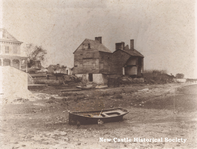
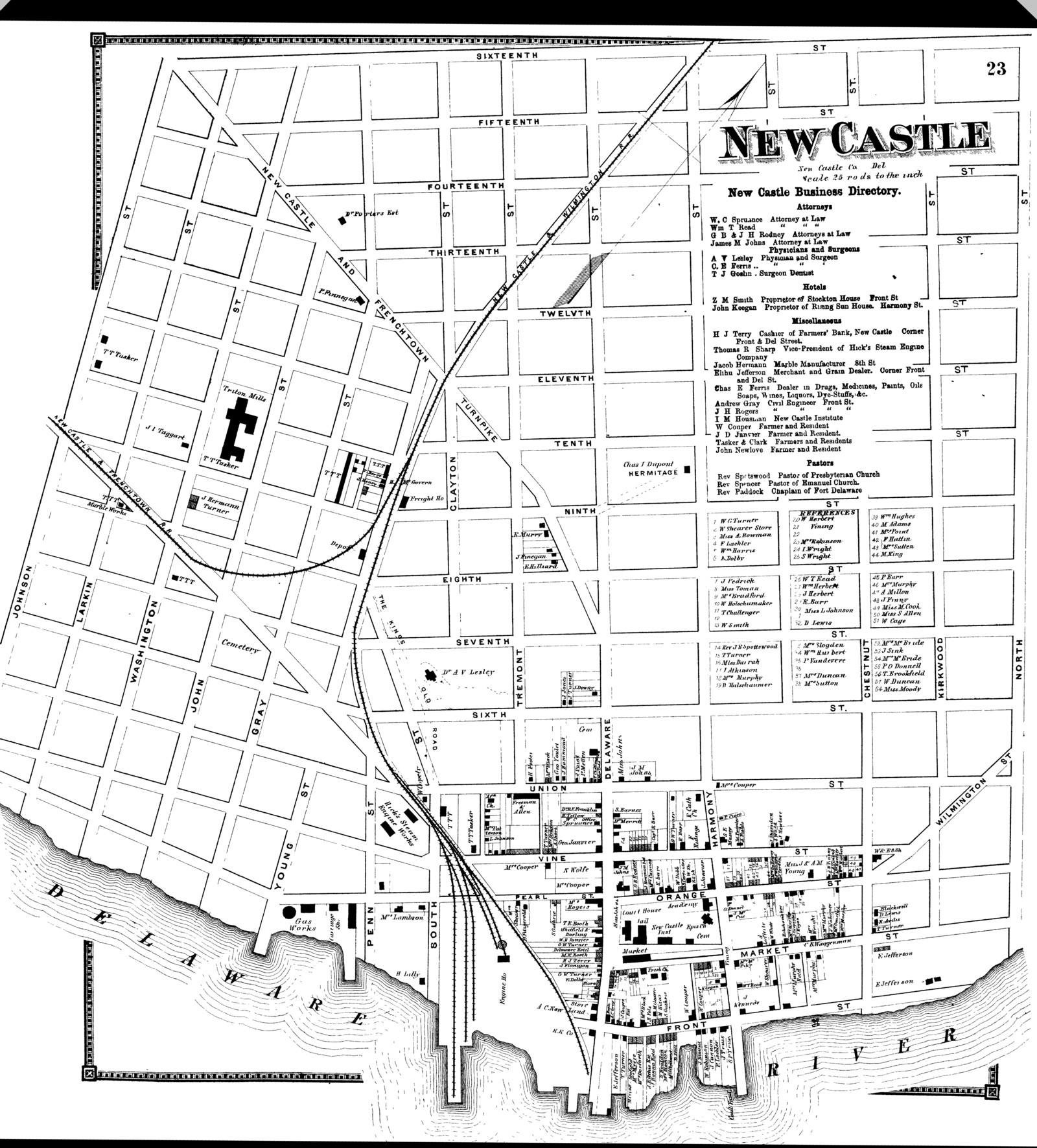
There were two buildings on the Strand adjacent to the water in both of the photographs above (the land side of the current Strand; the water side was underwater!). They were already old c1880, so both probably existed at the time of the 1863 Beers Atlas. The houses are shown on either side of the current Plum Alley, according to the 1863 map.
The picture shows a few more buildings which are probably the backs of buildings on second street. Note the slight bluff at the river's edge.
Unfortunately, the picture does not go a few hundred feet further upstream, which would have been the site of Ft. Casimir. One of the attractive features of Ft. Casimir was the "high, fast land".