
Proposed location in 1704 (red) of the boundaries of New Castle Common. Properties currently owned by the Trustees
are shown in blue. The survey started "att an old corner Black Oake of Joseph Wood's [marked 'A'], standing
by the Rode [?Moores Lane?, green] that leades to Christina Fferry [4th St. Br., Wilmington?]". Its southern border ran from
"an old corner Spanish Oake ... standing by Maryland
Rode; then by the severall courses of the said Rode N. 84° Westerly 87
pch. N. 75° Westerly 134 pch... then by the severall courses of the Rode that Leads to Christina Bridge". The best
clue to location is the rectangular chunk of land missing in the survey at points marked W,X,Y,Z which seem to match School Lane
(next to the Pathmark and Home Depot on Rte 40).
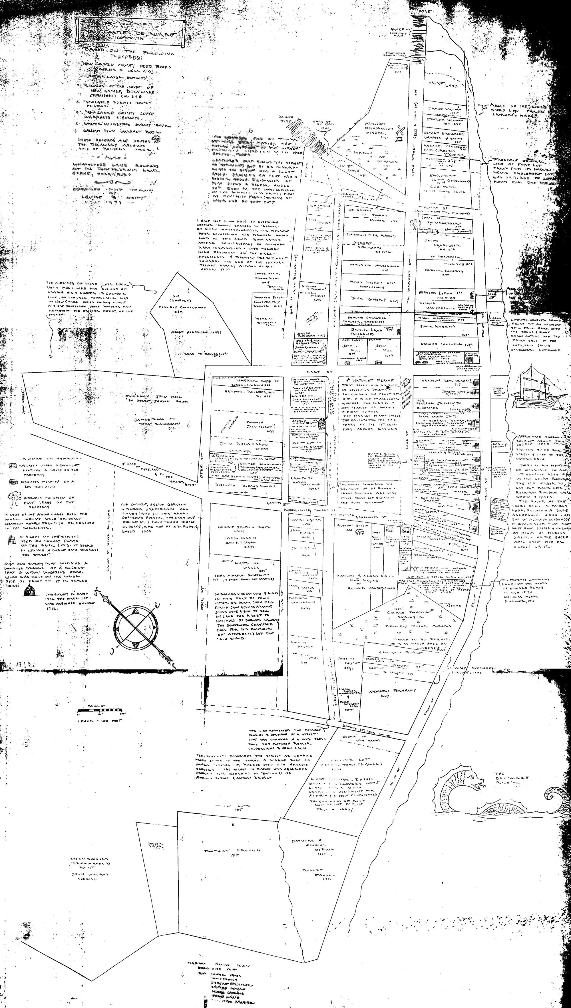
Survey in 1704 of lands of New Castle Common

What IS New Castle Common?
Where were the original lands?
HOW have the lands been used?
Are there any traces of the original marker trees?
The Trustees of New Castle Common is an organization chartered in 1764 to oversee control of approximately 1000 acres of land surveyed first in 1704 that was even earlier known to be land for the "onley use and behoofe" of the citizens of New Castle.
Since the charter expressly prohibited sale of any land, it remained intact except for condemnation for roads until 1941 when land was taken for the airport, and the trustees were able to purchase lands such as Battery Park and sell others, such as Penn Acres.
An interactive Google map shows the proposed location of the survey along with overlays of the whole survey, location of Penn Farm and other Common properties from the 1849 Rea & Price map.