Augustine Herrman's Map of Maryland, Delaware and Virginia (1670)
(Click on images to enlarge>
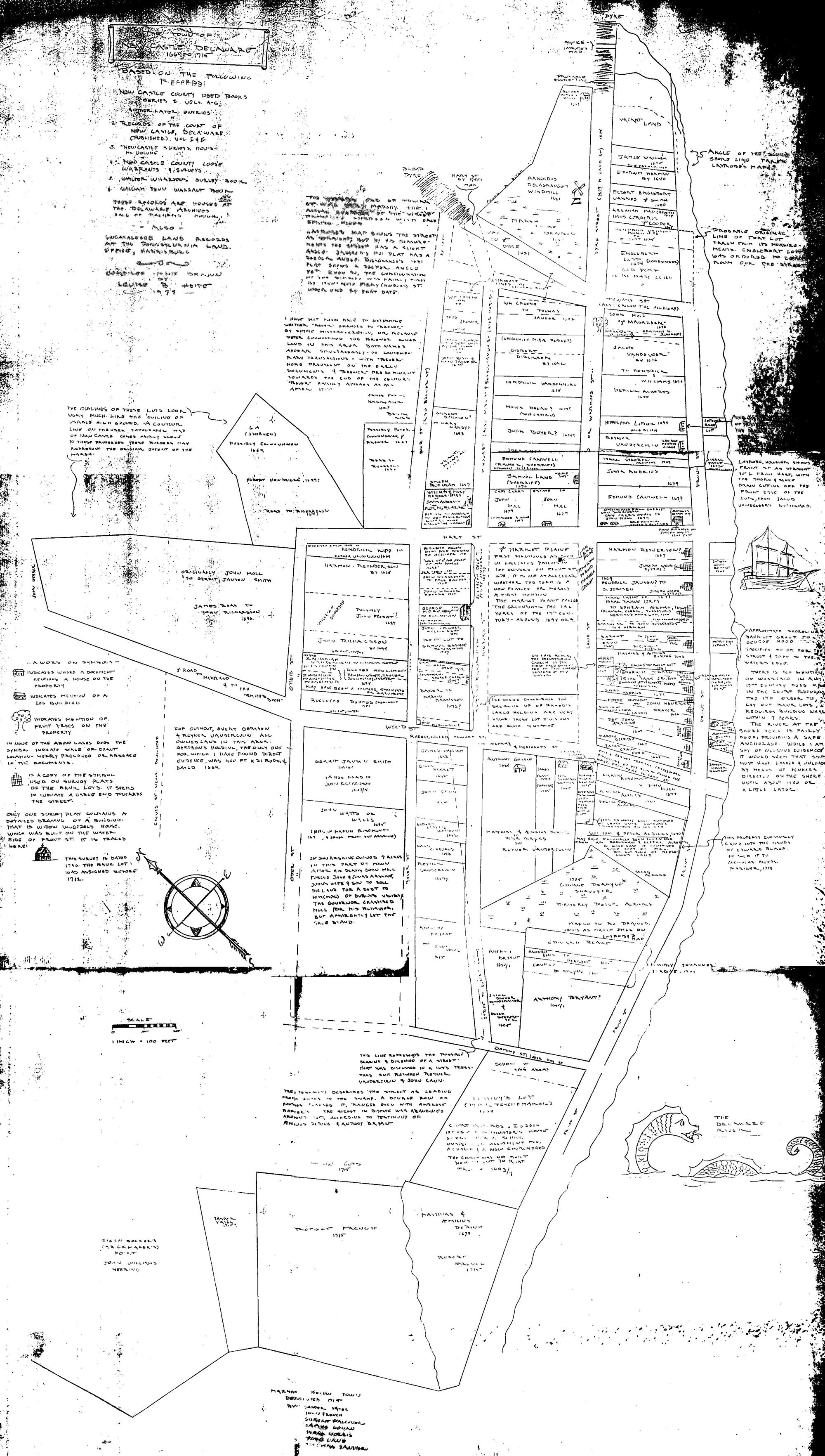
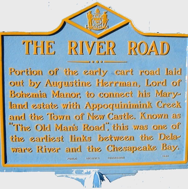 Motorists leaving New Castle to drive south along route 9 near the Brosius Eliason lumber yard
at the corner of South and 5th street may not notice
the historical
marker there commemorating the "old man's road". The cart road was built to connect New Castle to
the manor of Augustine Herman Bohemeiensis (evidently
he was proud of his (Czech) Bohemian ancestry). He was actually created a
lord of the manor on the Bohemia river in Maryland by Lord Baltimore
and granted citizenship. supposedly on the basis of a map!
Motorists leaving New Castle to drive south along route 9 near the Brosius Eliason lumber yard
at the corner of South and 5th street may not notice
the historical
marker there commemorating the "old man's road". The cart road was built to connect New Castle to
the manor of Augustine Herman Bohemeiensis (evidently
he was proud of his (Czech) Bohemian ancestry). He was actually created a
lord of the manor on the Bohemia river in Maryland by Lord Baltimore
and granted citizenship. supposedly on the basis of a map! The colorful story of his life would be unbelievable if made
into a movie. Pioneer, merchant, explorer, surveyor, map maker, patriot, rebel, and finally
Lord!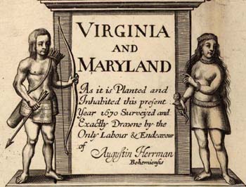 Accurate
maps are always desirable, but in the late 1600s crucial for establishing
boundaries of the new colonies. Herman's map was based on that
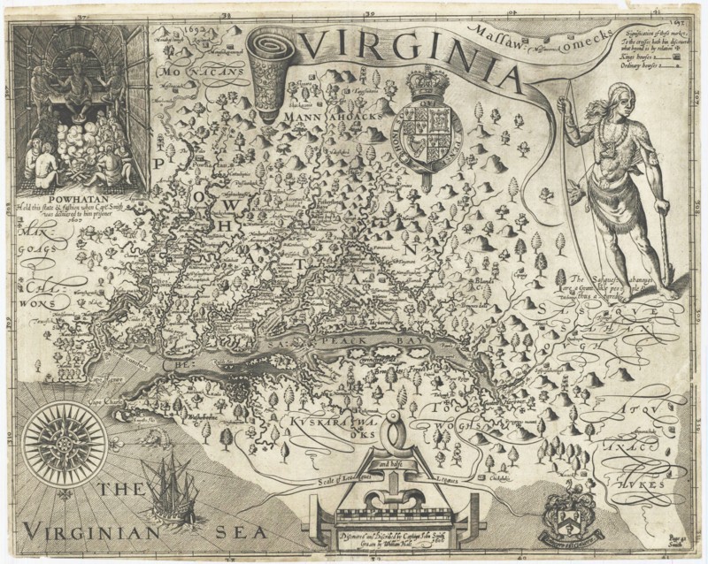
of Capt. John Smith's map of Virginia of 1612. That map, created in the time of
Shakespeare, and just 100 years after the invention of movable type printing was
oriented the way a mariner would enter the Chesapeake --> from left to right.
Accurate
maps are always desirable, but in the late 1600s crucial for establishing
boundaries of the new colonies. Herman's map was based on that
of Capt. John Smith's map of Virginia of 1612. That map, created in the time of
Shakespeare, and just 100 years after the invention of movable type printing was
oriented the way a mariner would enter the Chesapeake --> from left to right.
 King Charles
I subsequently gave Maryland to the first Lord Baltimore
King Charles
I subsequently gave Maryland to the first Lord Baltimore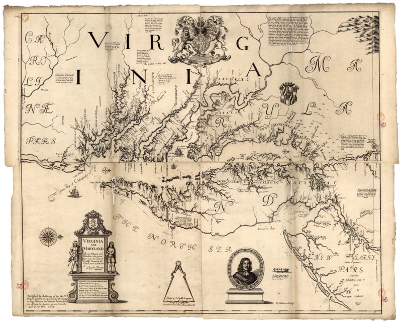 in 1631. (See the pdf of orignal
charter
-- 1 mb). The charter specifies the 40th parallel as the northern limits of the
grant. The Augustine Herman map 40 years later had considerably greater
detail in the area of Maryland than the John Smith map. After the
Maryland charter there was a beheading of Charles I, civil war,
protectorate of Cromwell, another civil war and now in 1681 a charter to
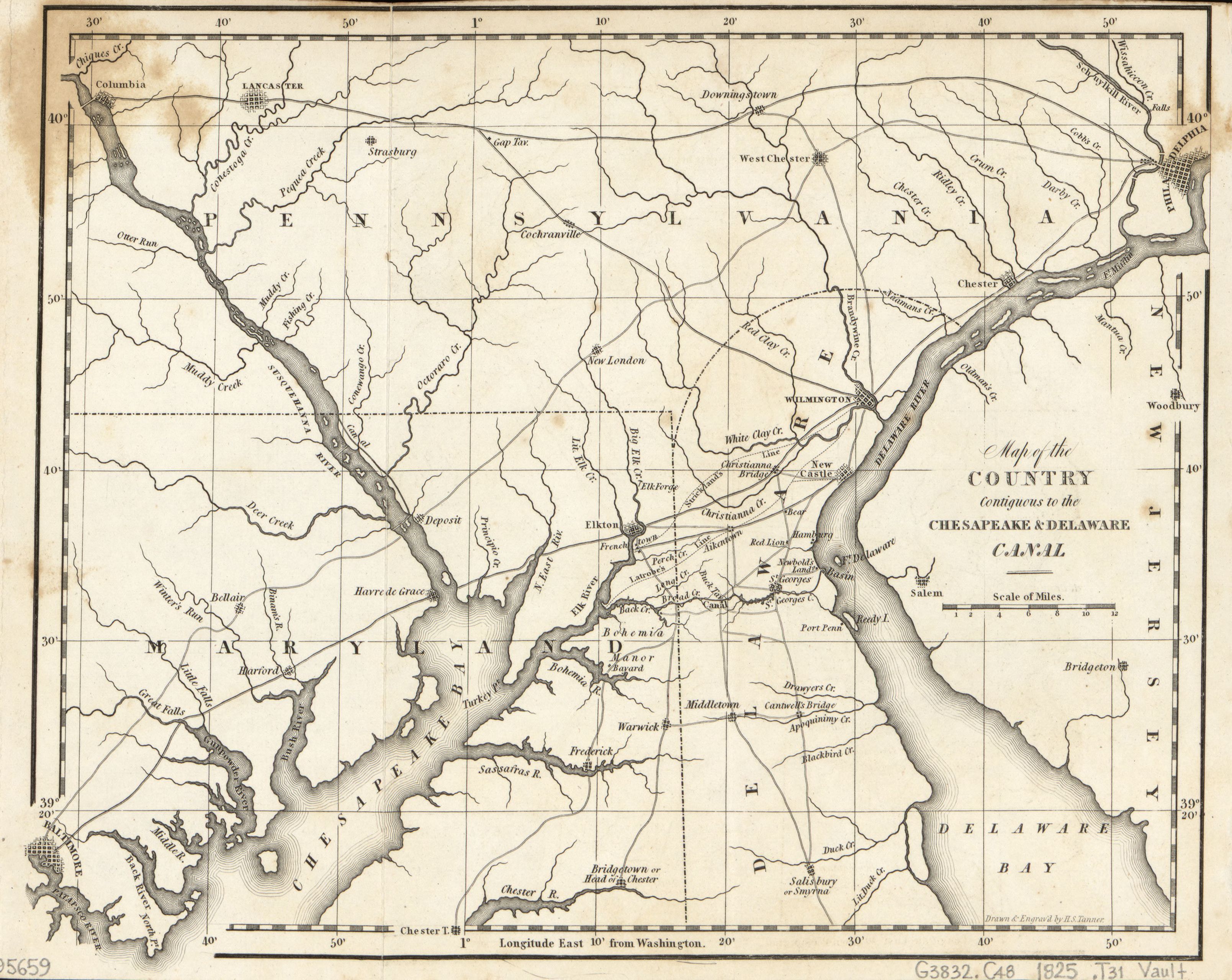
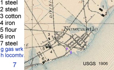
William Penn. Both the Herrman map and one sold by John Speed just 3 years later include
New Castle, and its position as related to the 40th parallel. This was
important, as detailed in an article on
mapping Pennsylvania, since the border
between Pennsylvania and Maryland at the 40th parallel was based on the charter of King Charles
I in 1631 as amended by King Charles II to give to Penn, which specified the
boundary as a circle 12 miles from the New Castle Courthouse, and then west
along the 40th parallel. As noted in the Mapping Pennsylvania, there was a
considerable variation in the location assigned to New Castle. The
map even included soundings of the Delaware River off the town of New Castle - 4-6 (fathoms? - 24-36
feet).
in 1631. (See the pdf of orignal
charter
-- 1 mb). The charter specifies the 40th parallel as the northern limits of the
grant. The Augustine Herman map 40 years later had considerably greater
detail in the area of Maryland than the John Smith map. After the
Maryland charter there was a beheading of Charles I, civil war,
protectorate of Cromwell, another civil war and now in 1681 a charter to
William Penn. Both the Herrman map and one sold by John Speed just 3 years later include
New Castle, and its position as related to the 40th parallel. This was
important, as detailed in an article on
mapping Pennsylvania, since the border
between Pennsylvania and Maryland at the 40th parallel was based on the charter of King Charles
I in 1631 as amended by King Charles II to give to Penn, which specified the
boundary as a circle 12 miles from the New Castle Courthouse, and then west
along the 40th parallel. As noted in the Mapping Pennsylvania, there was a
considerable variation in the location assigned to New Castle. The
map even included soundings of the Delaware River off the town of New Castle - 4-6 (fathoms? - 24-36
feet). 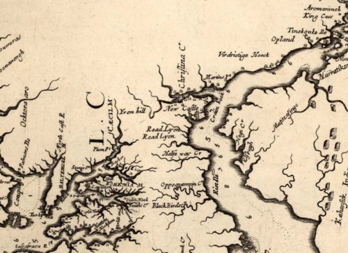
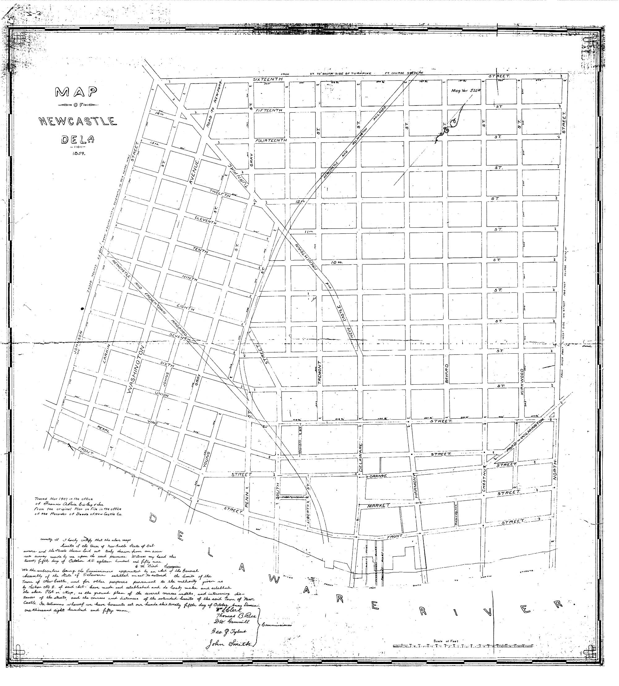
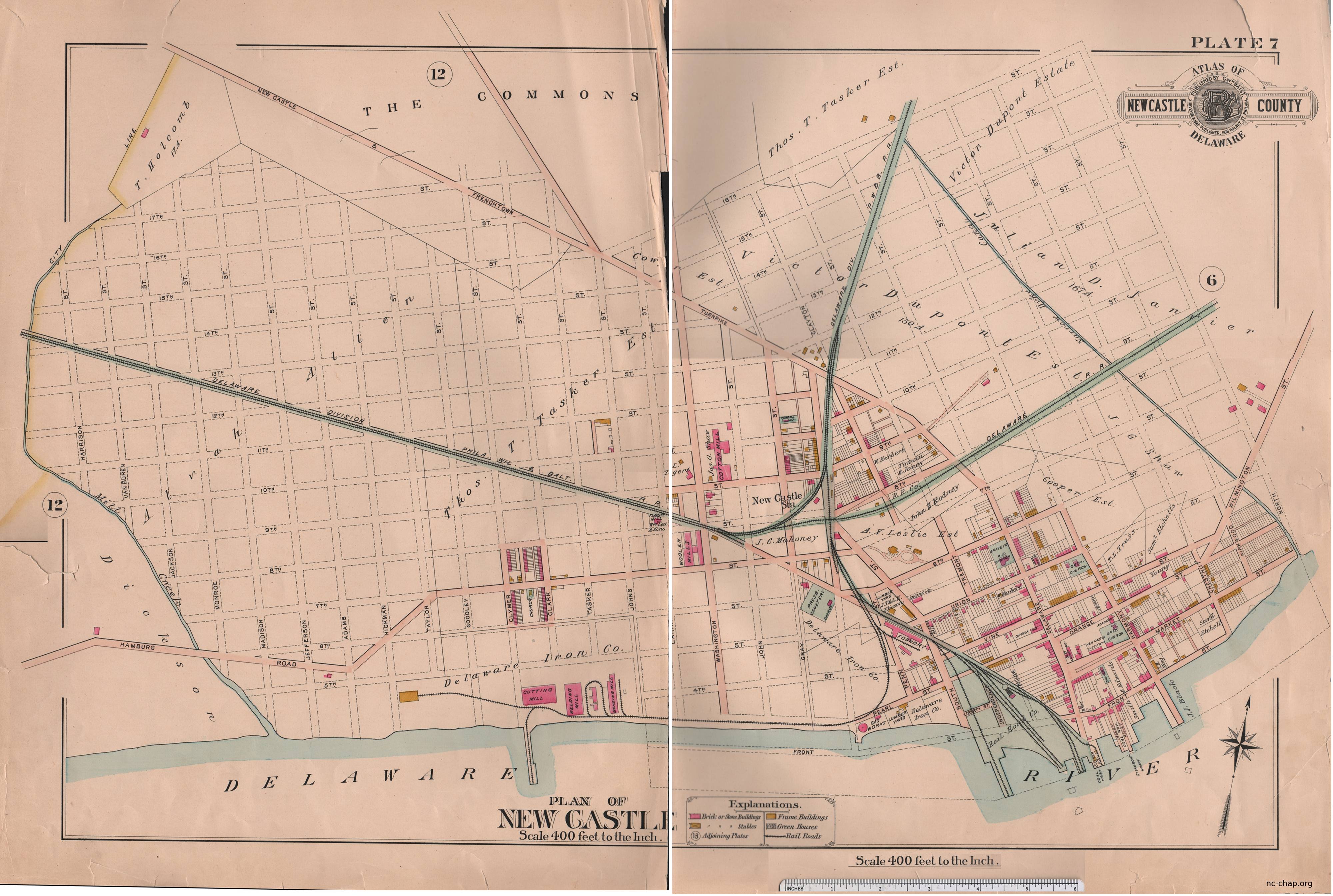
Herrman's son Ephraim lived in New Castle, at least originally in the
lot next to the current Read House, and subsequently near the site of Fort
Casimir at Chestnut and 2nd streets. Augustine disowned Ephraim because of
his involvement with the pietist Labadie sect.
High definition maps of John Smith, Herman and Speed are available on line from the Maryland Archives (2-3 Mb each). A print of the Speed map can be purchased from a commercial map vendor
.