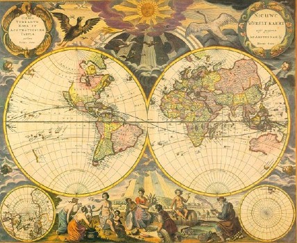
Pieter Goos Map of Nieuw Nederlandt(1667)
(Click on images to enlarge)
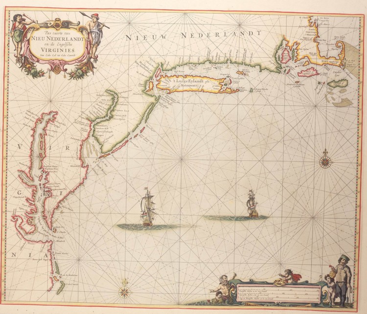 Pieter Goos of Amsterdam
produced beautiful maps of the new world, the world and southeast Asia for atlases in the 1600's. The detail of his map of
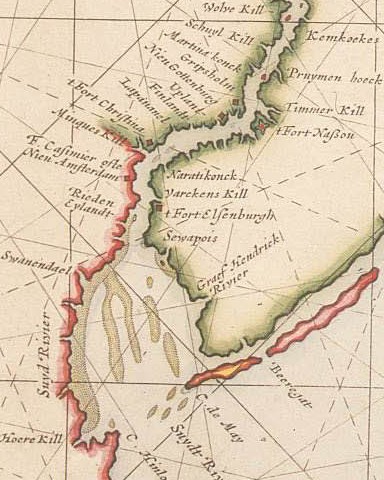
"Nieuw Nederlandt" in 1667 shows many familiar Pennsylvania, Delaware place names: (Reedy Island, Schulylkill, Upland, Cape May,
Cape Hinlopen, Barnegat) as well as unfamiliar:
Fort Nassau (the Dutch fort abandoned in favor of Fort Casimir), Whorekill = Swannendael (the predecessor to Lewes).
Pieter Goos of Amsterdam
produced beautiful maps of the new world, the world and southeast Asia for atlases in the 1600's. The detail of his map of
"Nieuw Nederlandt" in 1667 shows many familiar Pennsylvania, Delaware place names: (Reedy Island, Schulylkill, Upland, Cape May,
Cape Hinlopen, Barnegat) as well as unfamiliar:
Fort Nassau (the Dutch fort abandoned in favor of Fort Casimir), Whorekill = Swannendael (the predecessor to Lewes).
 Note that not only
Pennsylvania and surrouinding areas but also New England are called New
Netherland -- a brief effect of the 2nd Anglo Dutch war.
Note that not only
Pennsylvania and surrouinding areas but also New England are called New
Netherland -- a brief effect of the 2nd Anglo Dutch war.
Prints of this New Netherlands map are avalable
from the New Netherland Institute, Print of Goos' other maps are available online from
many sources. For an extensive description, history and images of maps of Pennsylvania (and Delaware), look at
Cramer's web site.