Nautical Charts
Navigation of the Delaware River has long been important. Closeup views of the charts used in earlier times are shown below. The whole charts can now be viewed online from NOAA's web site using a browser plugin for rapid closeup viewing of large map images.
What has not changed on the charts in more than 100 years is the depths of the water near the outer ice piers and the presence of 'range lights' as aids to navigation. These pairs of lights of different heights allow sailors to precisely identify the channel or where to change course.
What has changed frequently is the exact shoreline. While some New Castle (and Delaware City) residents attribute silting up of the waterfront or bays to the building of the 'jetty' just off the ship channel from New Castle to Pea Patch Island by the Corps of Army Engineers in 1932, mud flats were a feature of our shoreline long before the building of the jetty.
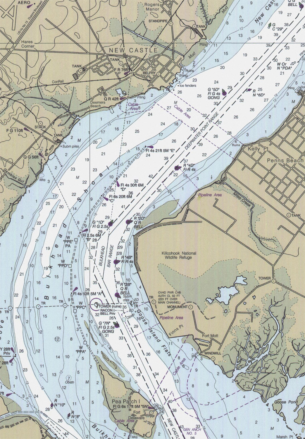
| 2000 12311-5-2000 Note the water depth of 26 ft in the year 2000 chart just off the outer ice pier, that the water is extremely shallow all along the waterfront -- 1 -3 ft above mean low water, the red range lights 42 and 76 feet high on shore and inshore respectively.and that the shoreline parallels the streets of town. In the enlarged view (click on the image), note that the ship channel is on the east side of the river, there is a second channel near the Delaware side, there is a submerged jetty running down to Pea Patch island, and that the New Castle range light marks the point where ships should turn on their course upstream. |
 |
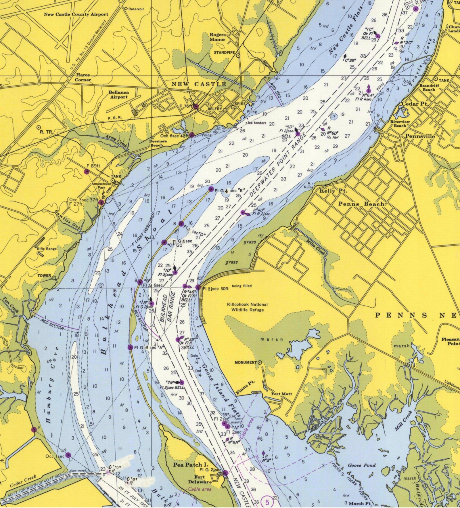
| 1974 Chart 12311-11-1974 1959 Chart 294_2-1959 In 1959 and 1974, the water depth is also quite shallow near land, but 26 ft deep at the ice piers, and the range lights are present. The shoreline is not parallel to the streets, but slopes in from Harmony to the Ferry terminal at Chestnut. The Bellanca runway is shown. The jetty ends at a level between Deemer's beach and the separate amusement park at the end of Bulkhead Shoal. North of town is the New Castle flats area. |
 |
| 1897
cp2174c The soundings in this chart are in fathoms (1 fathom=6 ft) except for in stippled shallow areas, in feet. Near the ice piers, the depth is still around 30 feet, and 1-3 ft near shore. North of town is the "New Castle Flats" area. In the enlarged view, note that the range lights are below town, and show the channel up from the canal area. Note also the "bulkhead shoal", built before the bulkhead running down to pea patch island. |
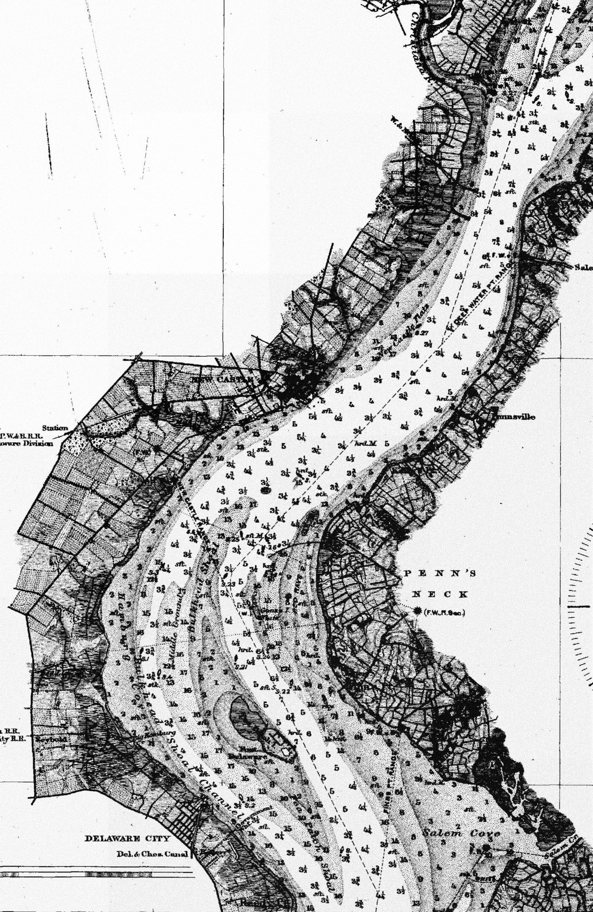 |
1877 Chart 126-5-1877 In 1877, the notice to mariners describe two marked channels around Peak Patch Island. 'Newly constructed' range lights are aids to navigation around eastern (wider) channel. The railroad lines is still shown as the New Castle & Frenchtown Railroad. Modern Hares Corner was a very rural Clarke's Corner. Army Creek was shown as Mill Creek. There is an unidentified pier or fishing structure south of town. near a few buildings (pre-Dobbinsville?), Strangely, there is no sign of the 'river road' (route 9). The water just off New Castle is again 5 fathoms (30 ft). The enlarged view does not show the 'New Castle mud flats' seen in the 1887 chart. |
 |